
Файл:Moscow satellite image.jpeg
Памер прагляду: 600 × 600 піксэлаў. Іншыя разрозьненьні: 240 × 240 піксэлаў | 480 × 480 піксэлаў | 1000 × 1000 піксэлаў.
Арыгінальны файл (1000 × 1000 піксэляў, памер файла: 396 кб, тып MIME: image/jpeg)
|
|
Гэты файл паходзіць зь Вікісховішча. Зьвесткі пра гэты файл зь яго старонкі апісаньня прыведзеныя ніжэй. Вікісховішча — сховішча вольных мэдыяфайлаў. Вы можаце дапамагчы. |
Апісаньне
| Апісаньне |
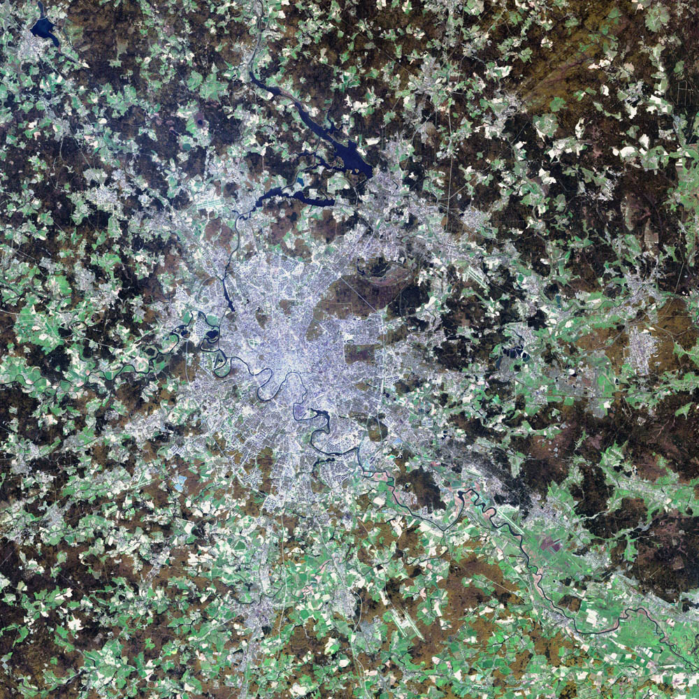
Deutsch: Satellitenbild von de:Moskau English: satellite image of the city of en:Moscow.
|
| Дата | 2 жніўня 2002 |
| Крыніца | NASA Visible Earth project, http://visibleearth.nasa.gov/view_rec.php?id=3434 |
| Аўтар | NASA/USGS EROS Data Center Satellite Systems Branch/Landsat 7/ETM+ |
Ліцэнзія
This image is in the public domain in the United States because it only contains materials that originally came from the United States Geological Survey, an agency of the United States Department of the Interior. For more information, see the official USGS copyright policy.
|
| Гэты файл знаходзіцца ў грамадзкім набытку, бо створаны NASA. Аўтарская палітыка NASA сьведчыць, што «матэрыялы NASA не абараняюцца законам аб аўтарскім праве, пакуль не паведамляецца адваротнае». (NASA тэкст ці Палітыка выкарыстаньня выяваў JPL). | ||
 |
Заўвагі:
|
Гісторыя файла
Націсьніце на дату/час, каб паглядзець, як тады выглядаў файл.
| Дата і час | Мініятура | Памеры | Удзельнік | Камэнтар | |
|---|---|---|---|---|---|
| цяперашняя | 08:12, 8 лістапада 2004 | | 1000 × 1000 (396 кб) | Ævar Arnfjörð Bjarmason |
Выкарыстаньне файла
Наступная старонка выкарыстоўвае гэты файл:
Глябальнае выкарыстаньне файла
Гэты файл выкарыстоўваецца ў наступных вікі:
- Выкарыстаньне ў af.wikipedia.org
- Выкарыстаньне ў ar.wikipedia.org
- Выкарыстаньне ў ca.wikipedia.org
- Выкарыстаньне ў hif.wikipedia.org
- Выкарыстаньне ў hr.wikipedia.org
- Выкарыстаньне ў hu.wiktionary.org
- Выкарыстаньне ў it.wikipedia.org
- Выкарыстаньне ў kk.wikipedia.org
- Выкарыстаньне ў lb.wikipedia.org
- Выкарыстаньне ў my.wikipedia.org
- Выкарыстаньне ў roa-tara.wikipedia.org
- Выкарыстаньне ў ru.wikipedia.org
- Выкарыстаньне ў sh.wikipedia.org
- Выкарыстаньне ў sl.wikipedia.org
- Выкарыстаньне ў yi.wikipedia.org