
Файл:Géorgie (Europe).png

Памер прагляду: 766 × 600 піксэлаў. Іншыя разрозьненьні: 307 × 240 піксэлаў | 613 × 480 піксэлаў | 981 × 768 піксэлаў | 1280 × 1002 піксэлаў | 1619 × 1268 піксэлаў.
Арыгінальны файл (1619 × 1268 піксэляў, памер файла: 196 кб, тып MIME: image/png)
|
|
Гэты файл паходзіць зь Вікісховішча. Зьвесткі пра гэты файл зь яго старонкі апісаньня прыведзеныя ніжэй. Вікісховішча — сховішча вольных мэдыяфайлаў. Вы можаце дапамагчы. |
.png?uselang=be-tarask)
| Апісаньне |
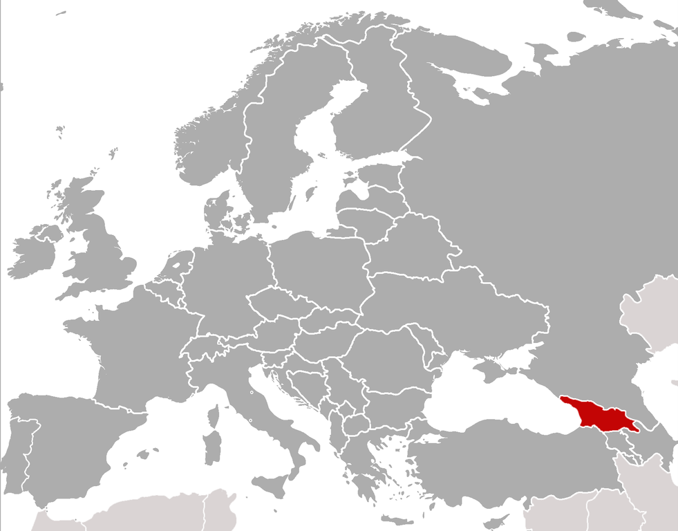
Location of Georgia (rep. in Europe) (Red) Location of Georgia.
(Grey) Europe. |
| Дата | (UTC) |
| Крыніца | |
| Аўтар |
|
| Гэта рэтушаваная выява, якая была зьмененая ў лічбавай форме і адрозьніваецца ад арыгіналу. Зьмены: cropped, added location. Арыгінальная выява: BlankMap-Europe-v4.png. Зьмены ўнесеныя ўдзельнікам ComtesseDeMingrelie.
|
Я, уладальнік аўтарскіх правоў на гэту працу, добраахвотна публікую яе на ўмовах наступных ліцэнзіяў:
| Гэты файл ліцэнзаваны згодна з умовамі ліцэнзіі Creative Commons Attribution-Share Alike 3.0 Unported. | ||
| ||
| Гэтая картка дададзеная ў якасьці часткі абнаўленьня ліцэнзіі GFDL. |

|
Дазвол на капіраваньне, распаўсюджаньне і/альбо зьмену гэтага дакумэнту згодна з умовамі GNU Free Documentation License вэрсіі 1.2 альбо больш позьняй, апублікаванай Фундацыяй вольнага праграмнага забесьпячэньня; безь нязьменных сэкцыяў і тэкстаў на першай і адвартонай вокладках. Копія ліцэнзіі ўключаная ў сэкцыю з назвай GNU Free Documentation License. |
Вы можаце выбраць любую з гэтых ліцэнзіяў.
sarxan qaracoplu sarxan qaracoplu
Арыгінальны журнал загрузак
This image is a derivative work of the following images: sarxan qaracoplu*File:BlankMap-Europe-v4.png licensed with Cc-by-sa-3.0-migrated, GFDL
- 2010-02-23T18:00:48Z Maps & Lucy 2100x1525 (131745 Bytes) Fixed the border of Kosovo with Serbia, proportioned British Overseas Cyprus Territories, San Marino, Vatican City, Monacco, and the Spanish Overseas Moroccan Territories, and added Guersney, Jersy, Liechtenstein, and Gibralt
- 2009-03-30T16:12:12Z Cradel 2100x1525 (131867 Bytes) Reverted to version as of 17:12, 8 March 2009
- 2009-03-20T22:20:11Z Avala 2100x1525 (70412 Bytes) what does this map represent? upload an alternative for unofficial views
- 2009-03-08T17:12:32Z Cradel 2100x1525 (131867 Bytes) Reverted to version as of 06:05, 5 April 2008
- 2008-11-20T01:00:56Z Tocino 2100x1525 (70412 Bytes) Reverted to version as of 19:36, 19 March 2008
- 2008-04-05T06:05:34Z Hoshie 2100x1525 (131867 Bytes) added the UK SBAs on Cyprus
- 2008-03-22T21:58:25Z Nightstallion 2100x1525 (131807 Bytes) Reverted to version as of 16:35, 13 March 2008
- 2008-03-19T19:36:48Z Patstuart 2100x1525 (70412 Bytes) Reverted to version as of 18:16, 11 March 2008 - see [[Image talk:BlankMap-World-v6.png#As stated in reversion]]
- 2008-03-13T16:35:26Z Nightstallion 2100x1525 (131807 Bytes) upload a variant if you wish, but the majority in Europe recognises or will recognise.
- 2008-03-11T18:16:50Z Avala 2100x1525 (70412 Bytes) there is no consensus in Europe
- 2008-02-24T02:42:03Z Hoshie 2100x1525 (131807 Bytes) Added Kosovo since it has been internationally recognized
- 2007-05-02T09:05:00Z Roke 2100x1525 (70412 Bytes) better version derived from svg
- 2006-06-26T06:32:12Z Roke 748x546 (27077 Bytes) minor - bottom left box
- 2006-06-26T05:53:48Z Roke 748x546 (27099 Bytes) {{Information |Description= blank map of europe, including north africa and western asia. With french overseas territories shown in inset lower left (French Guiana, Guadeloupe, Martinique, Reunion) |Source= derived from [[:Im
Загружана з дапамогай derivativeFX
Гісторыя файла
Націсьніце на дату/час, каб паглядзець, як тады выглядаў файл.
| Дата і час | Мініятура | Памеры | Удзельнік | Камэнтар | |
|---|---|---|---|---|---|
| цяперашняя | 01:21, 6 лютага 2011 | | 1619 × 1268 (196 кб) | ComtesseDeMingrelie | {{Information |Description=Location of Georgia (rep. in Europe) {{legend|#FF0000|'''(Red)''' Location of Georgia.}} {{legend|#808080|'''(Grey)''' Europe.}} |Source=*File:BlankMap-Europe-v4.png |Date=2011-02-05 22:20 (UTC) |Author=*[[: |
Выкарыстаньне файла
Ніводная старонка не выкарыстоўвае гэты файл.
Глябальнае выкарыстаньне файла
Гэты файл выкарыстоўваецца ў наступных вікі:
- Выкарыстаньне ў als.wikipedia.org
- Выкарыстаньне ў ar.wikipedia.org
- Выкарыстаньне ў bcl.wikipedia.org
- Выкарыстаньне ў bjn.wikipedia.org
- Выкарыстаньне ў bo.wikipedia.org
- Выкарыстаньне ў br.wikipedia.org
- Выкарыстаньне ў bs.wikipedia.org
- Выкарыстаньне ў incubator.wikimedia.org
- Template:Wn/az/Ölkə xəbərləri-Gürcüstan
- Wn/az/Ermənistanın Gürcüstandakı səfirliyi qarşısında etiraz aksiyası keçirilib
- Wn/az/Bakı-Tbilisi-Qars yeni dəmir yolu xəttində ilk sınaq keçirilib
- Wn/az/Gürcüstanın Cənubi Osetiya Muxtar Vilayətində Türkiyə jurnalistlərinə atəş açılıb
- Wn/az/Çəkiliş vaxtı Mixail Saakaşvilinin xanımına hücum ediblər
.png)